
UN Votes to Adopt New World Map Showing Africa's True Size
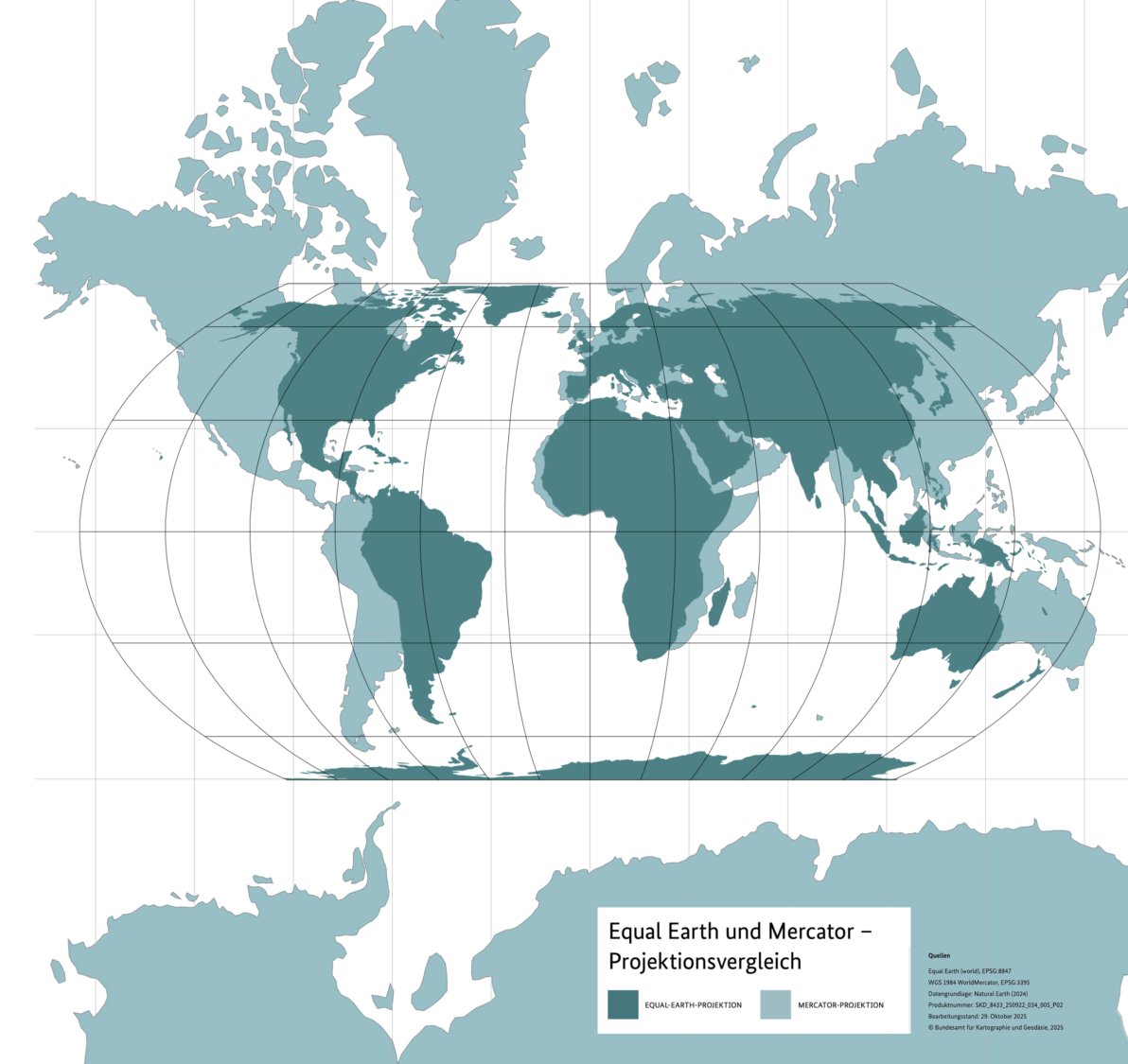
Equal Earth vs. Mercator projection comparison. Source: Bundesamt für Kartographie und Geodäsie (Germany's Federal Agency for Cartography and Geodesy), 2025
The UN General Assembly has passed a resolution promoting the Equal Earth map projection over the centuries-old Mercator map, which shrinks Africa to roughly the visual size of Greenland despite the continent being about 14 times larger.
The UN General Assembly has voted 164 to 1, with 6 abstentions, to adopt the "Correct the Map" resolution, which promotes the Equal Earth projection as a more accurate alternative to the centuries-old Mercator map for general use. The United States cast the only vote against it.
The Mercator projection, devised by Gerardus Mercator in the 16th century for maritime navigation, distorts the relative size of landmasses the further they sit from the equator, inflating countries near the poles. Under Mercator, Greenland appears roughly the same size as Africa, even though Africa is around 14 times larger. Critics of the map's continued everyday use in classrooms, media and policy argue it visually diminishes Africa while exaggerating the scale of Europe and North America.
The resolution was co-sponsored by the African Union and the Bahamas, with Togo leading the AU's campaign. Togolese Foreign Minister Robert Dussey summed up the push: "A fair world begins with a fair map." France, also a co-sponsor, said it would abandon routine use of the Mercator projection in favor of more accurate representations.
The United States was the sole dissenting vote, with its representative arguing the resolution promoted an "ideological agenda" that distracted from more pressing international issues.
The resolution is not legally binding, and the Mercator projection remains in use for maritime and aerial navigation, where its properties are still considered useful. Its broader significance is symbolic: reversing what campaigners describe as a 450-year-old, colonial-era distortion in how Africa is visually represented to the world.